
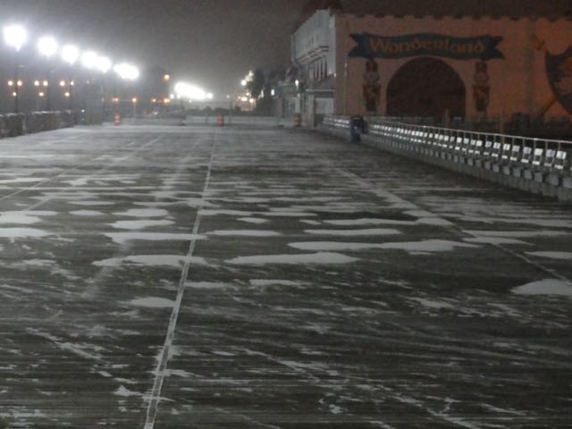
A coating of light snow had blanketed Ocean City by about 7:30 p.m. Friday as the leading edge of a big winter storm moved into the area.
Forecasters predict that Ocean City will see tidal flooding, high winds, snow, sleet and rain before the storm passes on Sunday.
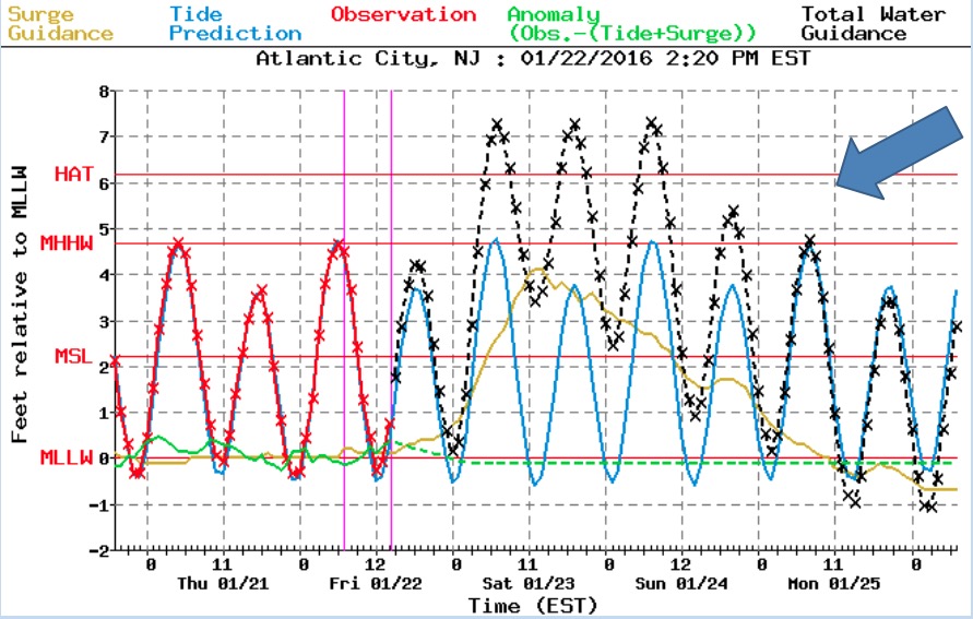
With northeast winds gusting up to 60 mph and pushing ocean water onshore and with a full moon on Saturday, Ocean City can expect substantial flooding during high tides at 7:28 a.m. Saturday, 7:54 p.m. Saturday and 8:11 a.m. Sunday (tides at the Ninth Street Bridge on Ocean City’s bay side).
Check back with OCNJ Daily throughout the day on Saturday for images and updates on the storm, its impact and on tide levels. And check tide levels in real time at the gauge at the Bayside Center on the 500 block of Bay Avenue in Ocean City (add 2.77 to the tide levels in the NAVD 1988 numbers reported there to convert to the mean low water scale commonly used by forecasters).
The National Weather Service briefing released at 5 p.m. Friday predicts a tidal surge of about 7.3 feet in Atlantic City for all three tides. The same forecast calls for a tidal surge well beyond 8 feet in Lewes, Del. on Saturday morning. (See chart of historic flood levels in Ocean City for context.)
A Coastal Flood Warning, a High Wind Warning and a Winter Storm Warning remain in effect for Ocean City through Sunday morning.
_________
Sign up for free news updates from OCNJ Daily.
_________
City officials are reminding residents to move vehicles from areas that typically experience tidal flooding and to never attempt to drive through flood waters.
Northeast winds of 35 to 45 mph with higher gusts can be expected through Saturday night. The forecast suggests an overnight snow will turn to rain on Saturday before more snow falls on Saturday night. The most recent forecast calls for a potential accumulation of 3 to 6 inches.
West Avenue is a “Snow Removal Zone” and parking is prohibited on both sides of the street when it’s snowing.
See the most recent National Weather Service briefing below.


