Harry Holmes
Quick Moving Winter Storm For Thursday Morning
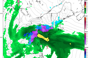
Spring-like temperatures are gone and is replaced by a rapidly developing but quick moving winter storm. Heavy rain changing to snow, dropping temperatures and strong gusty winds is on tap for your Thursday. Unlike the rest of New Jersey, we are expected to get the least amount of snow as the brunt of the storm will be in the form of rain, while areas to our North & West will be getting pounded with heavy wet snow...
Winter Storm Arrives Thursday Morning
A Winter Storm is headed our way with the potential of significant to major snowfall over the much of the Northeastern U.S. Pretty amazing given the fact that temperatures will be in the upper 50s today with 60s inland. There will be a big difference in snow accumulations across the state due to the expected track of the storm and changeover times of rain to snow...
Some Snow Possible Despite Mild Temperatures
It's hard to imagine that we are talking about a threat of some snow later this week when daytime temperatures are in the 50s. It has been pretty typical this winter that we go from mild to cold and back to mild within a week and it looks like this pattern will continue.
Cold Start To The Weekend
A large High Pressure system from Canada will stretch across the Eastern U.S. and keep us quite cold as we head into the weekend. Friday will feature a good deal of clouds with highs remaining in the upper 30s...
Snowy Monday Morning
The first of a series of weak disturbances set to move through this week will bring a quick shot of snow Monday morning. A Winter Weather Advisory is in effect for our area with a light accumulation expected to cause conditions to be a bit slick for your Monday morning commute.
A low pressure system will develop off the Delmarva coast and quickly move away. This will create a narrow band of accumulating snow across Southern Delaware and Cape May & Atlantic Counties...
Cold But Not Frigid Weekend, Some Snow Chances Ahead
Now that the January thaw is over, our weather pattern has shifted to more normal mid-winter conditions. Seasonably cold temperatures have settled into our area and will continue through next week. While the pattern will be on the dry side for the most part, there will be a few chances of snow.
But first the weekend. It will be chilly & breezy with highs in the low 40s. High temperatures for most of the week will also range in the upper 30s to low 40s...
Mild For Now..Cold Air Set To Return
A return to brighter and drier conditions following the nasty Nor'easter will be a welcome change. Enjoy the mild midweek, because it's not going to last.
High Pressure will move in briefly today bringing sunny skies and a dry west wind which will push temperatures into the low 50s...
2 Hour School Delay & Weather Update as Nasty Nor’easter Continues
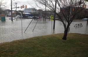
The Ocean City School District announced earlier this evening that all schools will be opening with a 2 hour delay tomorrow morning (1/24), as a result of the significant flooding and the timing of the high tide tomorrow morning. Students that ride the bus should report to their normal pick-up locations 2 hours later than normal.
The strong coastal storm continues to pound the NJ coast. While the brunt of the storm is ending tonight, we not out of the woods yet.
High Wind Warning until Midnight
Strongest wind gusts have ended but it will continue to be windy through tonight and even tomorrow. A High Wind Warning will expire tonight as the low pressure moves north. Winds gusts still could exceed 50 mph Monday night. As the storm slowly pulls away on Tuesday, winds will still be busy from the northwest 20-25 mph with gusts over 30mph...
Miserable Monday: Coastal Storm Will Pack A Punch Along NJ Coast
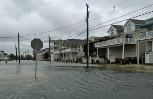
It nasty start to the week as a strong coastal storm moves into our area. While this storm will not be like last year's January storm, heavy rain, high winds and tidal flooding will make travel difficult on Monday...
Coastal Storm Set To Bring Heavy Rain, Flooding
It was almost a year ago that we were dealing with a major coastal storm. The infamous Winter Storm "Jonas", as it was called, dumped heavy snow then heavy rain along the coast with strong gusty winds and significant flooding. Now another coastal storm is set to bring another dose of heavy rain, gusty winds and flooding for late Sunday into Monday. Only this time, you don't have to worry about the snow.
Rain will arrive late Sunday as a low pressure system to our south will begin moving offshore. The difference between the High Pressure to our north and Low Pressure to our south will cause a tight gradient for a period of time over our area allowing strong onshore winds to increase rapidly late Sunday night into Monday...


