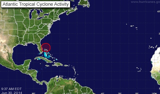
A weather disturbance near Florida could possibly become 2014’s first named tropical storm within 48 hours.
Forecasters predict a track for what would be Tropical Storm Arthur parallel to the East Coast of the United States but over the open water of the Atlantic Ocean.
Based on early computer guidance, NBC40 meteorologist Dan Skeldon suggested on Monday that Arthur’s potential track “would mean high surf for July 4th for us, but the main impacts from any system should stay offshore.”
Skeldon said the Outer Banks of North Carolina might have more of a concern.
“As the dry air and wind shear diminish at midweek, there will be room for the system to organize, strengthen and drift northward,” AccuWeather Hurricane Expert Dan Kottlowski said.
“People heading to the beaches on the Atlantic coast from Florida to southern New England can expect a couple of days on average of rough surf.”
A separate front moving across the country possibly could bring heavy rain on Thursday. See the National Weather Service briefing on both systems in the PDF below.
__________
Sign up for OCNJ Daily’s free newsletter and breaking news alerts
“Like” us on Facebook


