
By MADDY VITALE
While the worst of a nor’easter that slammed the coastline with strong wind gusts and flooding may be over, Ocean City officials cautioned that residents should continue to keep up on the latest weather conditions.
The storm effects will continue through Wednesday, officials said.
“The two Monday high tides brought the highest water levels we have seen since October 2018,” Ocean City Public Information Officer Doug Bergen said Tuesday.
On Tuesday, the tide reached 6.06 feet at 11:40 a.m.
And it isn’t over.
“The forecast calls for a water level of 5.9 feet at 12:07 a.m. Wednesday,” Bergen pointed out. “So even though the worst of the storm has passed, residents should continue to monitor conditions and be sure that vehicles are in a safe place before going to bed tonight.”

On Monday, at least six vehicles were stranded in floodwaters. The strongest wind gusts were measured at 55 mph at the wind station at the 59th street parking lot. The sustained winds were 34 mph.
Winds continued to be strong on Tuesday and there was flooding in some areas of town. Beaches also sustained erosion, but it is too soon to determine how much at this point, Bergen said.
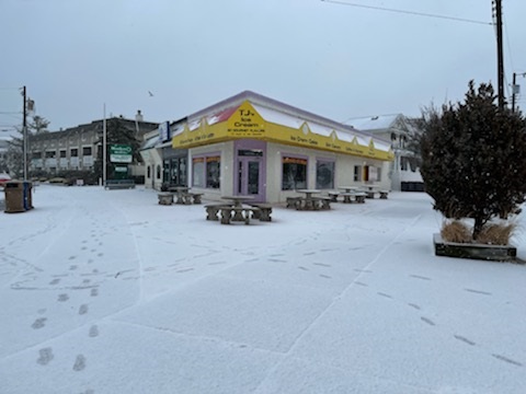
A few people ventured out to walk on the snow-dusted Boardwalk or take a chilly stroll on the beach. Traffic remained light as some snow fell. A lone surfer braved the cold to head into the chilly ocean. Some residents even made the most of the snowfall by making snowmen.
The National Weather Service issued a coastal flood advisory in effect for Ocean City through 4 a.m. Wednesday. The advisory predicts water levels in the range of minor flooding.
Bergen said that the island had moderate flooding on Monday.
He noted that the gauge at the Bayside Center recorded peaks of 6.67 feet (mean low water) late Monday morning and 6.72 feet late Monday evening.
“Those levels fall in the middle of the range for moderate flooding. At that level, cars left parked on low-lying streets suffer the worst of the storm damage,” Bergen explained.
Bergen said that the strong northeast winds peaked late Monday morning and early afternoon.
“They were the primary factor in driving water into the back bays. Coming about halfway between a full moon and new moon, the natural tides were relatively low, which helped to prevent further damage,” Bergen said.
He continued, “Any time you get a nor’easter sustained over several days, the beach will suffer erosion. We’ll get a better look when the storm tides recede.”


