
It looks as if we are going to see our 1st and possibly 2nd snow of the season. Unlike most snow events, both of these systems could result in Ocean City and the rest of Cape May County receiving the most snow in the entire state. Fortunately, both these systems are fast movers and accumulations should be limited. Cold air will begin to settle in tonight and temperatures on Thursday will only hold in the 30s. That means it will be cold enough for snow when the first low pressure system slides to our south late Thursday night. Light snow will develop after Midnight Thursday night. While this 1st storm is not expected to be strong, a period of snow will accumulate causing slick roadways and sidewalks early Friday morning. Accumulations of 1” -2” (possibly 3″) is possible before the storm exits.
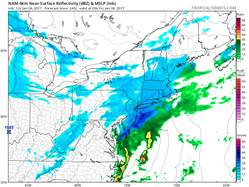
Computer models show a period of snow especially along the coast overnight Thursday night. (Courtesy: tropicaltidbits.com)
Cold air will hang around into the weekend as we wait for the 2nd storm to arrive. The track of the 2nd storm is still expected to remain offshore. The question is how close to the coast will this storm be as it moves by us. Models continue to differ on exact track but as it stands now, we could potentially see snow amounts on Saturday exceed 4″+ or virtually no snow at all. Heaviest snows are forecast to occur across the Carolinas and Southeastern Virginia.
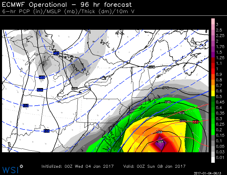 Latest European model, if correct, would give us the most snow as storm tracks closer to coast.
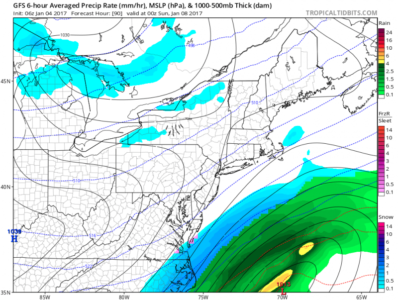 Latest American model shows storm further offshore. No snow. (Courtesy: tropicaltidbits.com)
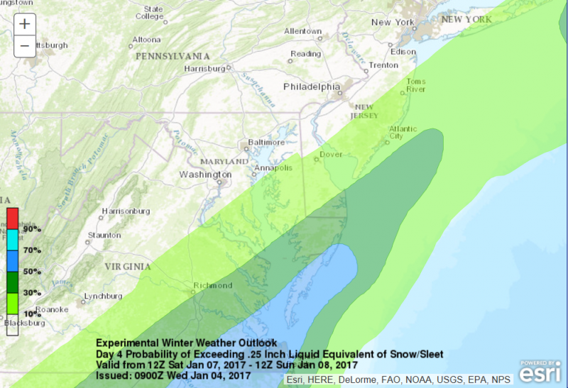 Highest Probability of accumulating snow for Saturday remains to the south & east.
We probably will have a better handle on the Saturday event once the 1st event moves through. The track of the 2nd storm is determined by the strength of the 1st storm. If 1st storm is stronger, it will force colder air to push further south and keep the 2nd storm further south & east.
What To Expect
1st event- Light Snow Likely
Arrives After Midnight Thursday night
Ends Early Friday Morning
Total Accumulation 1”-2” maybe 3″
2nd event- Snow Possible
Time frame to watch- During the day Saturday.
