The National Weather Service issued a flood watch in effect for 8 p.m. Saturday through 8 p.m. Sunday.
Heavy rainfall associated with the remnants of Tropical Storm Bill (which made landfall in Texas earlier this week) is expected to cross over the region starting Saturday night.
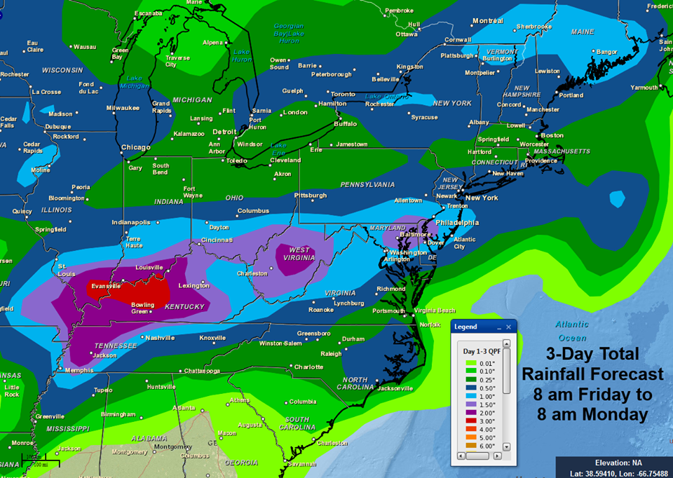
The NWS suggests many areas could see rainfall of 1 to 2 inches with pockets where 3 inches or more could fall.
High tides on the bay side of Ocean City are at 11:54 p.m. Saturday and 12:36 p.m. Sunday.
The exact track of the heaviest rain remains uncertain — though most forecasters are predicting the worst of the storm to arrive after midnight and end by 11 a.m.
Some forecasts call for a return of the sun by the afternoon on Sunday (Father’s Day). Others suggest the rain could continue into the evening.
If Ocean City is hit by substantial rain, residents and visitors staying on low-lying streets may want to consider moving vehicles to higher ground.


