The bicyclist is one of just a few people out on the chilly, stormy day.
 By MADDY VITALE
Wind gusts of up to 55 mph, flooding throughout Ocean City, an overflowing bay, downed power lines and outages and about six cars stuck in high stormwater made for a sloppy and unpleasant Monday.
City officials explained that the morning’s high tide and the result of it were not the worst of the storm. Monday night's high tide and strong winds were expected to bring even more flooding.
“The wind continues to be strong and is starting to shift a little bit to the north,” Ocean City Emergency Management Coordinator Frank Donato said at 1:30 p.m.
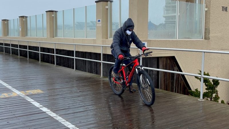
A bicyclist braves the stormy day while riding on the Boardwalk.
The high tide at 10:38 a.m. had crested by the afternoon and the water was receding, Donato added.
The storm's whipping winds, wintry mix of precipitation and temperatures in the 30s made for a day of inside activities.
A lone bicyclist took a ride on the Boardwalk in the afternoon. According to the Atlantic City Electric map, there were 17 power outages in the afternoon.
Donato noted that there was moderate flooding throughout areas of the island.
“There were a lot of bayside areas in town experiencing street flooding,” he said, adding that the one positive was that the city saw a couple of inches less of rain than what was originally predicted.
The National Weather Service had issued a coastal flood warning for the resort from 7 a.m. Monday through 5 p.m. Tuesday.
The NWS also issued a wind advisory through Monday evening with northeast winds blowing from 30 to 40 mph and gusts up to 50 mph, which exceeded the forecast.
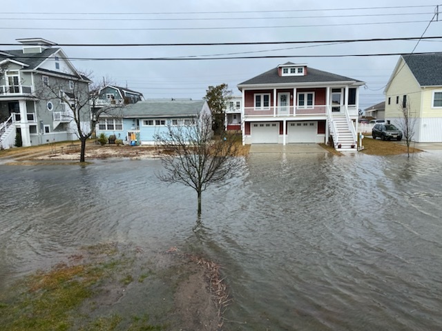
Victoria Lane is one area hit by flooding on Monday.
“The sustained winds of about 30 mph continued through the morning,” Donato said. “The heaviest gusts measured at the wind station at the 59th street parking lot were 55 mph.”
Streets such as West and Haven Avenues, Battersea Road, Victoria Lane and Asbury Avenue were just some of the water-soaked roadways. Water lapped over the bulkhead at the Ocean City Yacht Club. Floodwaters pooled in the roadways, making travel tricky and unsafe in some areas.
Streets, aside from some cars that traveled into floodwaters only to be stranded, were mostly barren.
Donato cautioned motorists that they should move cars to higher ground and never drive through floodwaters or drive around barricades
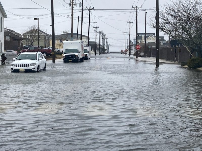
Cars parked on 11th Street and West Avenue aren't going anywhere until waters recede.
But at least six drivers did not heed warnings.
“Unfortunately, about a handful of cars were lost this morning,” Donato said.
“They were throughout the island. I saw one vehicle on 45th Street and one on 46th Street off West Avenue,” Donato said. “There are some others that you could see weren’t moved and water was likely inside the cars.”
Parking is available at the Trinity United Methodist Church at 20 North Shore Road in Marmora.
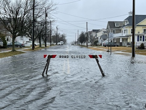
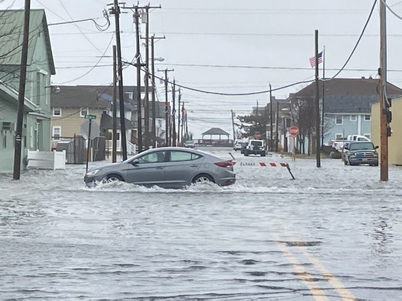
A "Road Closed" barrier at Battersea Road signals to vehicles not to drive through the waters.
But even as the floodwaters went down, Donato cautioned that the 11:15 p.m. high tide Monday may be even worse than the morning’s weather.
“We want to remind people to expect another similar dose of flooding,” he pointed out.
For police and fire department emergencies, call 911. For non-emergencies, call 609-399-9111. Visit www.ocnj.us/octides to compare the new predictions to other recent and historic tide levels.
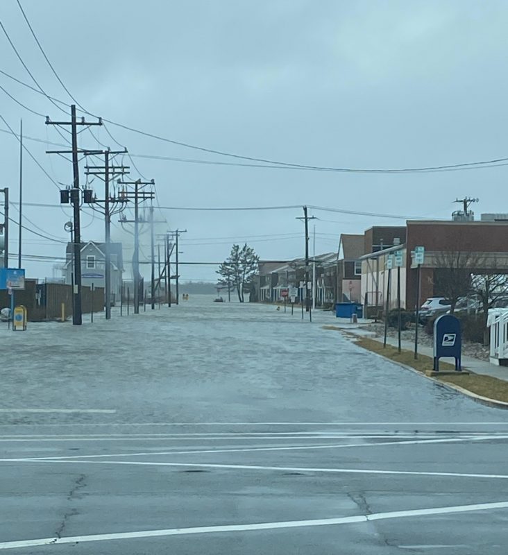
The flooded intersection at 34th Street and Haven Avenue is deserted.
 By MADDY VITALE
Wind gusts of up to 55 mph, flooding throughout Ocean City, an overflowing bay, downed power lines and outages and about six cars stuck in high stormwater made for a sloppy and unpleasant Monday.
City officials explained that the morning’s high tide and the result of it were not the worst of the storm. Monday night's high tide and strong winds were expected to bring even more flooding.
“The wind continues to be strong and is starting to shift a little bit to the north,” Ocean City Emergency Management Coordinator Frank Donato said at 1:30 p.m.
 A bicyclist braves the stormy day while riding on the Boardwalk.
The high tide at 10:38 a.m. had crested by the afternoon and the water was receding, Donato added.
The storm's whipping winds, wintry mix of precipitation and temperatures in the 30s made for a day of inside activities.
A lone bicyclist took a ride on the Boardwalk in the afternoon. According to the Atlantic City Electric map, there were 17 power outages in the afternoon.
Donato noted that there was moderate flooding throughout areas of the island.
“There were a lot of bayside areas in town experiencing street flooding,” he said, adding that the one positive was that the city saw a couple of inches less of rain than what was originally predicted.
The National Weather Service had issued a coastal flood warning for the resort from 7 a.m. Monday through 5 p.m. Tuesday.
The NWS also issued a wind advisory through Monday evening with northeast winds blowing from 30 to 40 mph and gusts up to 50 mph, which exceeded the forecast.
 Victoria Lane is one area hit by flooding on Monday.
“The sustained winds of about 30 mph continued through the morning,” Donato said. “The heaviest gusts measured at the wind station at the 59th street parking lot were 55 mph.”
Streets such as West and Haven Avenues, Battersea Road, Victoria Lane and Asbury Avenue were just some of the water-soaked roadways. Water lapped over the bulkhead at the Ocean City Yacht Club. Floodwaters pooled in the roadways, making travel tricky and unsafe in some areas.
Streets, aside from some cars that traveled into floodwaters only to be stranded, were mostly barren.
Donato cautioned motorists that they should move cars to higher ground and never drive through floodwaters or drive around barricades

 A "Road Closed" barrier at Battersea Road signals to vehicles not to drive through the waters.
But even as the floodwaters went down, Donato cautioned that the 11:15 p.m. high tide Monday may be even worse than the morning’s weather.
“We want to remind people to expect another similar dose of flooding,” he pointed out.
For police and fire department emergencies, call 911. For non-emergencies, call 609-399-9111. Visit www.ocnj.us/octides to compare the new predictions to other recent and historic tide levels.
 The flooded intersection at 34th Street and Haven Avenue is deserted.