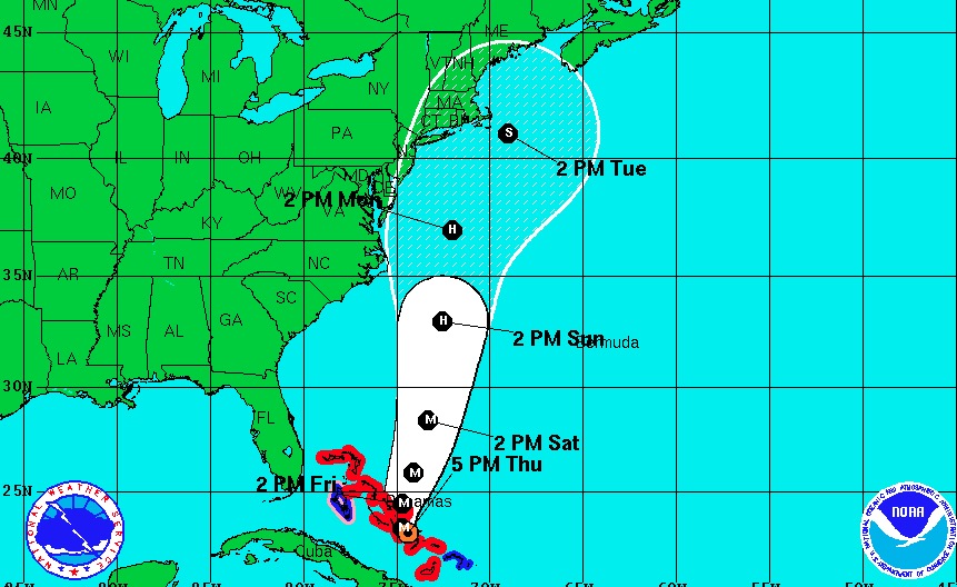
As of 5 p.m. Thursday, the National Hurricane Center's projected track for Hurricane Joaquin continues to move farther out to sea than in earlier forecasts.
As of Thursday afternoon, Hurricane Joaquin had been upgraded to a Category 4 storm with 130 mph winds as it bore down on the Bahamas.
While forecasters are still uncertain where the powerful storm will travel from there, they are starting to favor a track that would spare Ocean City — with the storm passing by out at sea.
"A strong majority of the forecast models are now in agreement on a track farther away from the East Coast," the National Hurricane Center reported in an update at 5 p.m. Thursday. "We are becoming optimistic that the Carolinas and the Mid-Atlantic states will avoid the direct effects from Joaquin. However, we cannot yet completely rule out direct impacts along on the east coast, and
residents there should continue to follow the progress of Joaquin over the next couple of days."
The most recent track forecast suggests the storm would pass Ocean City's latitude late Monday into Tuesday. If the storm were near, Ocean City would begin to feel the effects late Sunday into Monday.
Exceptionally strong northeast winds remain in the local forecast through the early part of next week.


