
The threat of minor coastal flooding is most serious on Sunday morning at high tide. (Courtesy of National Weather Service)
Another weekend. Another storm.
With plenty of slippery snow and ice from last weekend’s storm still coating the roads and sidewalks, get ready for another blast of nasty winter weather on Sunday.
Flooding, high winds gusting to 50 mph and even some light snow are expected at the shore starting Sunday morning and will possibly linger until Monday, according to the National Weather Service.
At the same time, dangerously cold wind chills between zero and minus 15 degrees are expected during the nighttime hours through Sunday morning, leading to an increased risk of hypothermia and frostbite.
The most frigid temperatures of the prolonged cold wave are expected Friday night into Saturday morning, with lows in the single digits to below zero.
Wind chills will be near zero on Sunday and mostly above zero starting Monday night. As has been the case for the past week, temperatures will remain well below normal through next week, with lows in the single digits and teens.
Some locations, though, could climb above freezing temperatures Tuesday through Thursday.
“Otherwise, the period of sub-freezing temperatures is likely to continue throughout next week. The longer this stretch of sub-freezing temperatures continues, the higher the risk of impacts, including to people and infrastructure,” the weather service said in a statement.
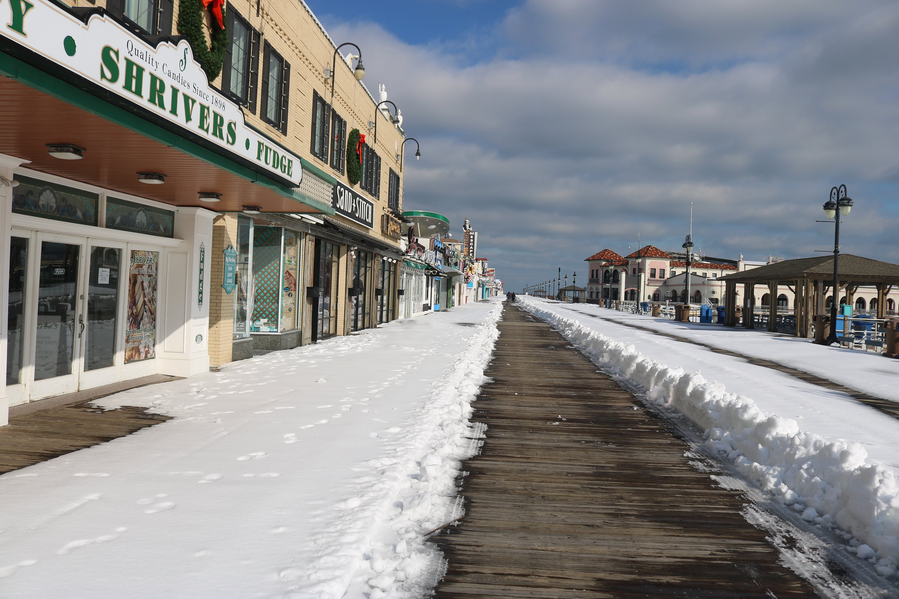 Typically bustling with people, the Boardwalk in Ocean City appears desolate a day after last weekend's storm.
 Flooding will be an added factor in this weekend’s storm. The weather service has issued a Coastal Flood Advisory in effect for the shore communities from 5 a.m. to 12 p.m. Sunday
A full moon and strong northerly winds from an offshore coastal storm will combine to cause “minor” coastal flooding during high tide on Sunday morning, according to the forecast.
“Minor tidal flooding could lead to roadway closures in low-lying areas near the coast and some tidal waterways. Ice on the back bays could further complicate expected impacts. Flood waters could freeze on roadways,” the weather service said.
The flooding will coincide with high tide on Sunday, possibly continuing into Monday morning. Highest water levels are expected with Sunday morning’s high tide.
Residents should move their vehicles to safe places well in advance of high tide. Local police departments are urging motorists not to drive on any streets covered by stormwater or to disregard barriers on flooded streets.
With temperatures remaining below freezing, motorists should use extra caution on roadways, even after the tide recedes. Roads could freeze over, police said.
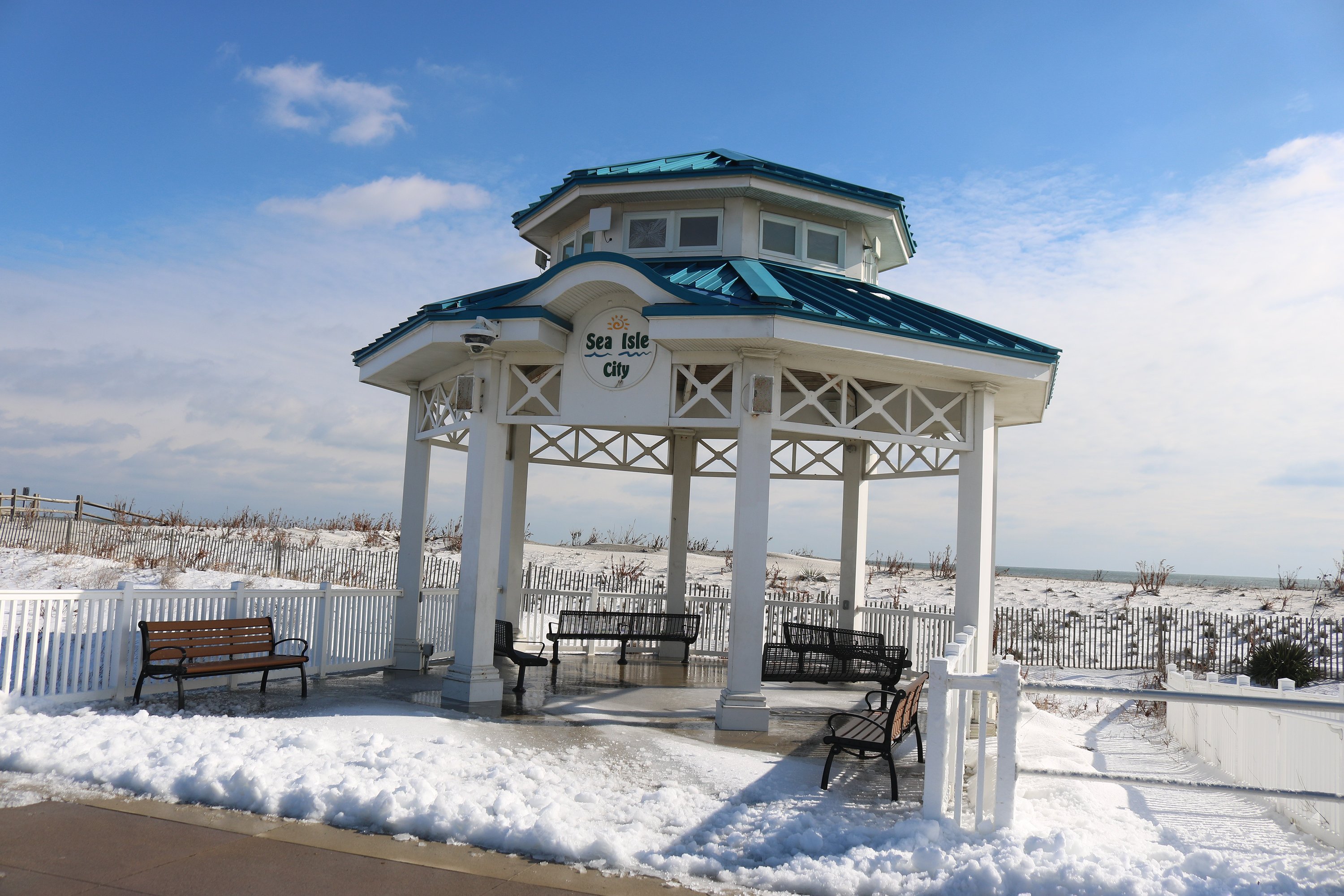 The gazebo on Sea Isle City's Promenade is surrounded by snow from last weekend's storm
Gusty north to northwest winds will increase Saturday night into Sunday. The strongest winds are expected along the coast, with gusts near 40 mph to 50 mph possible. Power outages and some tree damage are possible, too. Wind gusts between 25 mph and 35 mph are possible inland, according to the forecast.
If that’s not enough misery to go around, some snowfall could be added to the mix. However, the weather service says the coastal storm is shifting farther south and east offshore, which should hold down the snowfall totals to perhaps an inch.
“The highest snowfall totals, if any, are expected in southern Delaware and Cape May County, where a dusting to near 1” of snow is possible,” the weather service said.


