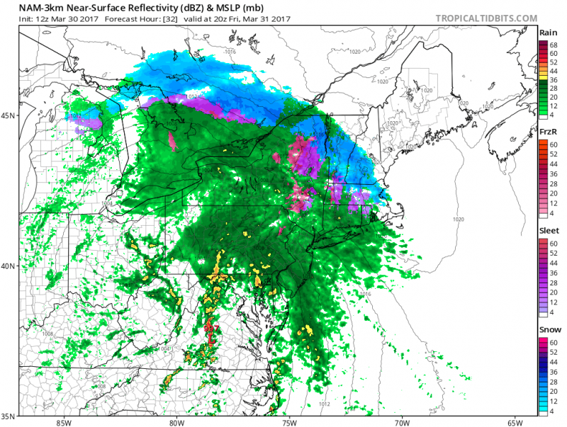
A wet and windy finish to the work week as a storm system loaded with moisture will be moving in from the Ohio Valley. Expect rain to be heavy at times with some tidal flooding during the day on Friday.
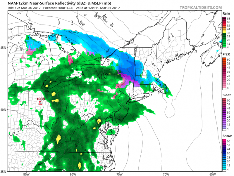 Computer models shows rain arriving early Friday morning.(Courtesy: tropicaltidbits.com)
Rain will be on the lighter side during the early morning hours but will become steadier and heavier late morning through the afternoon hours.
Winds will be quite busy out of the southeast 15-20 mph with gusts to 30 mph.
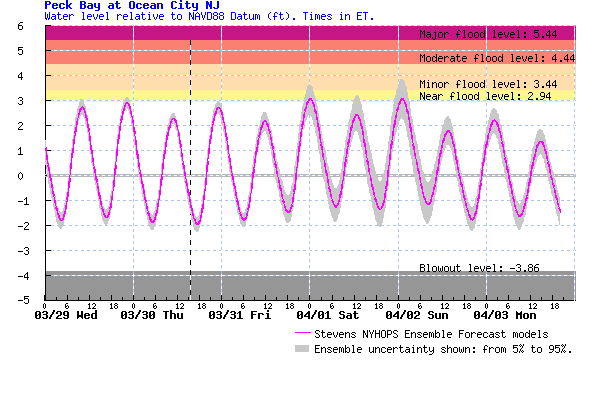
The steady southeast winds during the day and moderate to heavy rain will cause street flooding especially during Friday evening's high tide. Only minor coastal flooding is expected.
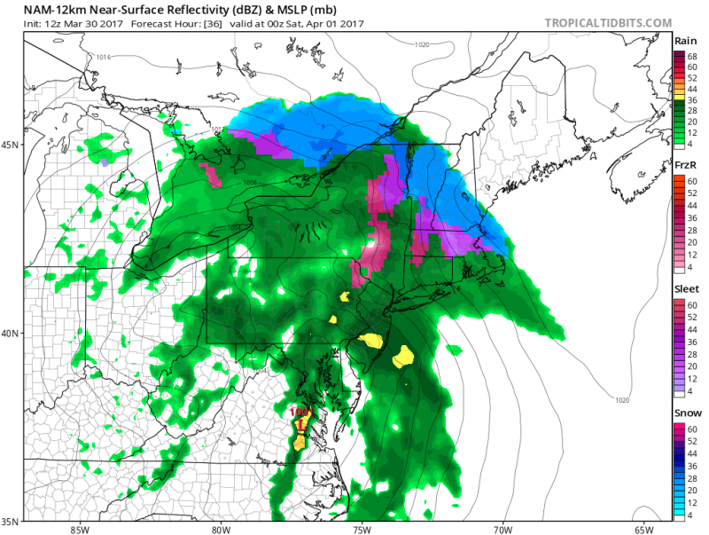
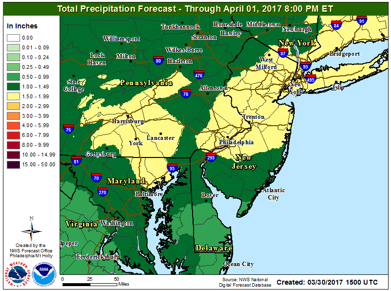
Rain will taper off Friday evening with occasional showers continuing through early Saturday morning. Total rainfall amounts could exceed 1".
Clouds will linger through Saturday morning with some clearing expected during the day. It will be breezy and still on the cool side with highs in the low 50s.
While most of Saturday will be dry, but the better half of the weekend will be on Sunday with more sunshine and temperatures in the mid 50s.
Looking for a dry, warm spell? Not so fast, we have 2 more storm systems expected next week as we remain in our cool, unsettled pattern with temperatures remaining in the 50s.
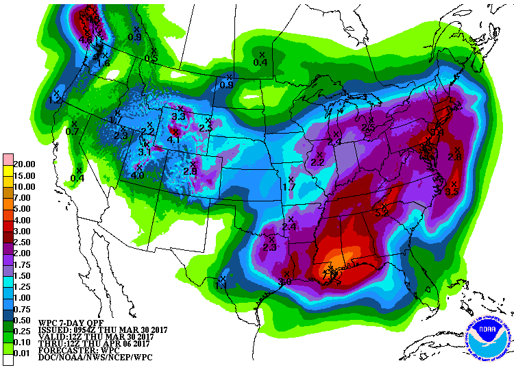 NOAA: Forecast rain amounts for the combined 3 storms could give us over 2.5"+.
 A wet and windy finish to the work week as a storm system loaded with moisture will be moving in from the Ohio Valley. Expect rain to be heavy at times with some tidal flooding during the day on Friday.
 Computer models shows rain arriving early Friday morning.(Courtesy: tropicaltidbits.com)
Rain will be on the lighter side during the early morning hours but will become steadier and heavier late morning through the afternoon hours.

 Rain will taper off Friday evening with occasional showers continuing through early Saturday morning. Total rainfall amounts could exceed 1".
 Clouds will linger through Saturday morning with some clearing expected during the day. It will be breezy and still on the cool side with highs in the low 50s.
While most of Saturday will be dry, but the better half of the weekend will be on Sunday with more sunshine and temperatures in the mid 50s.
Looking for a dry, warm spell? Not so fast, we have 2 more storm systems expected next week as we remain in our cool, unsettled pattern with temperatures remaining in the 50s.
 NOAA: Forecast rain amounts for the combined 3 storms could give us over 2.5"+.