This weekend we move our clocks ahead one hour for Daylight Saving Time. However, weather-wise we will be taking a step back. Another shot of arctic air returns this weekend and we are also watching the threat of snow. There is still a lot of uncertainty with this storm since we are still several days away. But first, our milder midweek.
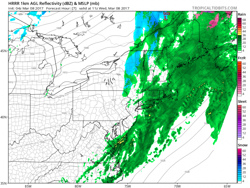 Showers along the front move through early Wednesday morning. (Courtesy:tropicaltidbits.com)
Showers will end early Wednesday morning as a front moves through the area. Sunshine returns during the afternoon on Wednesday and it will be breezy as winds shift westerly behind the front. The good news is that will push temperatures along the coast to near 60.
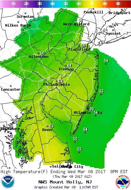
Thursday will be another sunny day but northwest winds will be busy...15-20mph with gust to 30mph. Temperatures will be a again in the 50s
Friday a weak disturbance moves through which could bring a period of rain and maybe ending as wet snow as colder air begins to filter in.
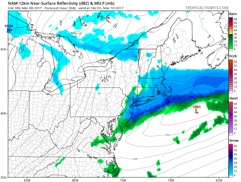 First weak low moves through on Friday with a period of rain ending as snow (Courtesy: tropicaltibits.com)
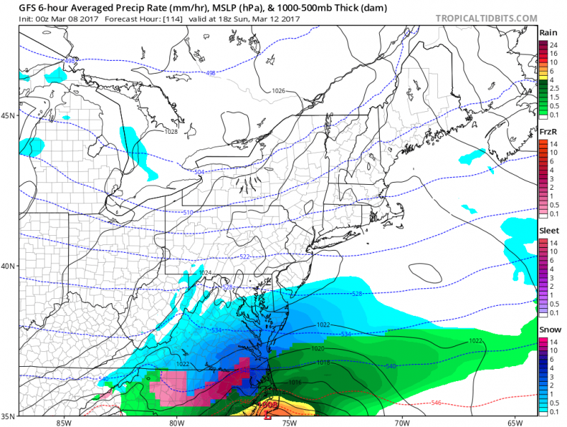
A more significant low pressure system could develop this weekend, but models have been trending further south due to a strong pool of arctic air over New England. This will suppress the storm track leaving us with little or no snow for this weekend.
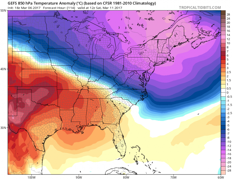
Strong Canadian High Pressure anchoring itself over New England will keep track further south.
 Computer models shows track further south keeping any significant snow south of the area. (Courtesy:tropicaltidbits.com)
Looking into next week, the weather pattern will remain active as another storm is could affect our area by Tuesday. Precipitation type still too far out to determine.
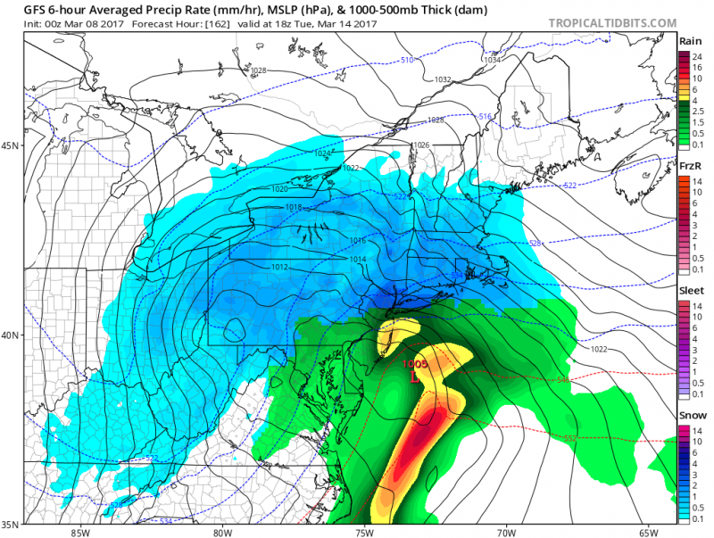 American model shows another storm for Tuesday. (Courtesy:tropicaltibits.com)
 This weekend we move our clocks ahead one hour for Daylight Saving Time. However, weather-wise we will be taking a step back. Another shot of arctic air returns this weekend and we are also watching the threat of snow. There is still a lot of uncertainty with this storm since we are still several days away. But first, our milder midweek.
 Showers along the front move through early Wednesday morning. (Courtesy:tropicaltidbits.com)
Showers will end early Wednesday morning as a front moves through the area. Sunshine returns during the afternoon on Wednesday and it will be breezy as winds shift westerly behind the front. The good news is that will push temperatures along the coast to near 60.
 Thursday will be another sunny day but northwest winds will be busy...15-20mph with gust to 30mph. Temperatures will be a again in the 50s
Friday a weak disturbance moves through which could bring a period of rain and maybe ending as wet snow as colder air begins to filter in.
 First weak low moves through on Friday with a period of rain ending as snow (Courtesy: tropicaltibits.com)
 Strong Canadian High Pressure anchoring itself over New England will keep track further south.
 Computer models shows track further south keeping any significant snow south of the area. (Courtesy:tropicaltidbits.com)
Looking into next week, the weather pattern will remain active as another storm is could affect our area by Tuesday. Precipitation type still too far out to determine.
 American model shows another storm for Tuesday. (Courtesy:tropicaltibits.com)