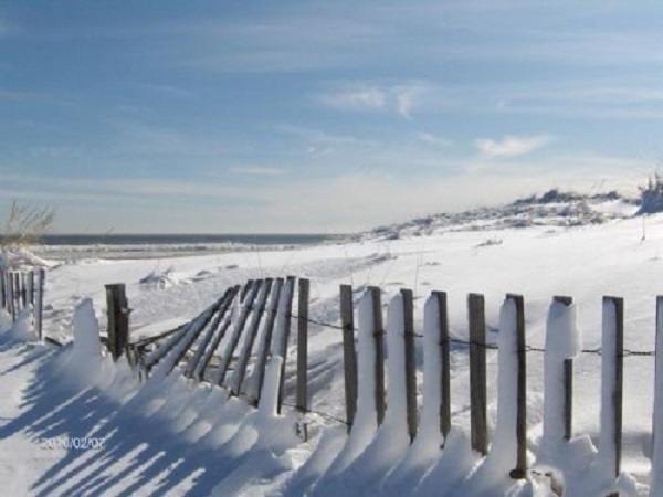
A Winter Weather Advisory continues this morning as light snow falls across the area. Fortunately, snow was not heavy enough to accumulate on most roads and sidewalks. Snow will end before 11am. Total accumulations of around 1" is expected on grassy areas and cars.
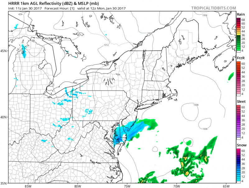
Sunshine should return during the afternoon and temperatures will top out in the upper 30s to near 40 degrees which will help with melting.
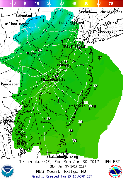 NOAA: Temperatures climb into the upper 30s which will help melt the snow.
Even though we will see some clearing this afternoon, we expect a quick shot of scattered snow showers to develop late this afternoon. Reduced visibilities for a short period of time is possible as these brief squalls move through and could produce a quick dusting.
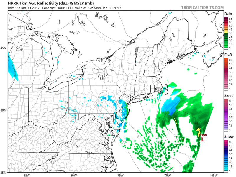 Computer models show late afternoon rain/snow showers moving through. (Courtesy: tropicaltidbits.com)
Keep in mind with clear skies Monday night, any wet surfaces will refreeze.
The next disturbance will swing by on Tuesday to our north. Any snow from this system will be confined across North Pennsylvania and Northwestern NJ. For us, only a slight chance of a shower.
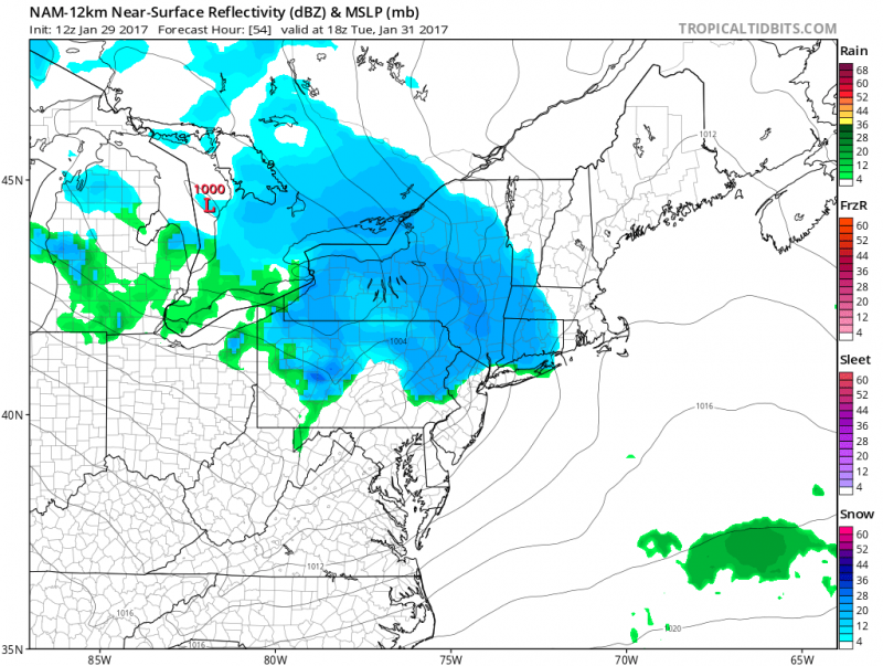 Computer models show next disturbance moves by to our north. (Courtesy: tropicaltidbits.com)
For the remainder of the week will be tranquil with high temperatures in the low to mid 40s.
Our next colder blast will arrive Friday & Saturday which will be followed by a significant storm next Sunday & Monday. More on that later this week...
 A Winter Weather Advisory continues this morning as light snow falls across the area. Fortunately, snow was not heavy enough to accumulate on most roads and sidewalks. Snow will end before 11am. Total accumulations of around 1" is expected on grassy areas and cars.
  Sunshine should return during the afternoon and temperatures will top out in the upper 30s to near 40 degrees which will help with melting.
 NOAA: Temperatures climb into the upper 30s which will help melt the snow.
Even though we will see some clearing this afternoon, we expect a quick shot of scattered snow showers to develop late this afternoon. Reduced visibilities for a short period of time is possible as these brief squalls move through and could produce a quick dusting.
 Computer models show late afternoon rain/snow showers moving through. (Courtesy: tropicaltidbits.com)
Keep in mind with clear skies Monday night, any wet surfaces will refreeze.
The next disturbance will swing by on Tuesday to our north. Any snow from this system will be confined across North Pennsylvania and Northwestern NJ. For us, only a slight chance of a shower.
 Computer models show next disturbance moves by to our north. (Courtesy: tropicaltidbits.com)
For the remainder of the week will be tranquil with high temperatures in the low to mid 40s.
Our next colder blast will arrive Friday & Saturday which will be followed by a significant storm next Sunday & Monday. More on that later this week...