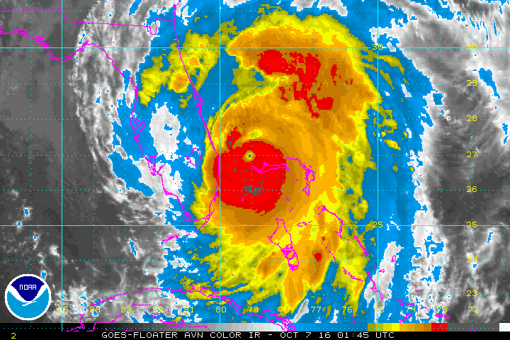
Hurricane Matthew is wreaking havoc along the Florida coastline and working its way north along the Georgia & South Carolina coastline. Hurricane warnings remain in effect for most of the Florida coast into South Carolina.
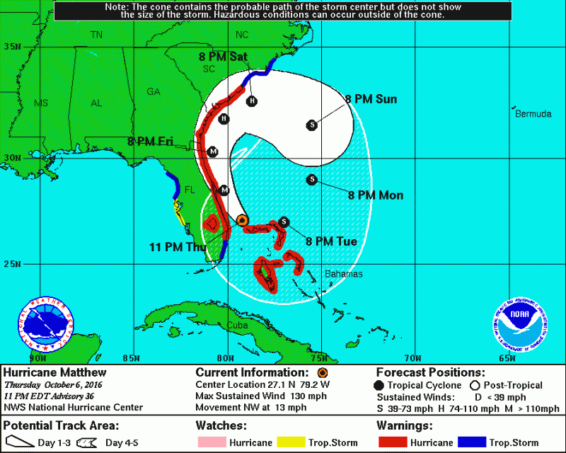
Matthew will mainly remain just offshore allowing the outer eyewall with the strongest wind and heaviest rain batter the coast. Matthew is getting pulled northwestward, then northward, as it rides around a ridge of high pressure. Matthew will then get pulled northeast as a cold front moves towards the East Coast. This will cause the entire Southeast Coast to experience hurricane force conditions as it curves along the coastline. Matthew will slowly weaken over the next few days but will remain a hurricane along the entire span of the Southeast Coast. Flooding rainfall, damaging winds and damaging storm surge is expected along the entire coast. As a result, loss of power is expected. Residents in the warned area that did not evacuate were asked to stock at least 3 days of food and water.
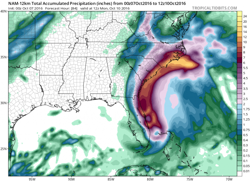 Courtesy: Tropicaltidbits.com
Rainfall amounts will range between 6-12 inches with local amounts up to 15 inches. Tides will also run 7-11 feet above normal during high tides.
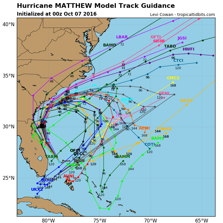
Computer models still show that Matthew loop around and move back down toward Florida. However, Matthew will have gone trough significant weakening due to strong wind shear and is forecast to be the minimal tropical storm by next week.
 Hurricane Matthew is wreaking havoc along the Florida coastline and working its way north along the Georgia & South Carolina coastline. Hurricane warnings remain in effect for most of the Florida coast into South Carolina.
 Matthew will mainly remain just offshore allowing the outer eyewall with the strongest wind and heaviest rain batter the coast. Matthew is getting pulled northwestward, then northward, as it rides around a ridge of high pressure. Matthew will then get pulled northeast as a cold front moves towards the East Coast. This will cause the entire Southeast Coast to experience hurricane force conditions as it curves along the coastline. Matthew will slowly weaken over the next few days but will remain a hurricane along the entire span of the Southeast Coast. Flooding rainfall, damaging winds and damaging storm surge is expected along the entire coast. As a result, loss of power is expected. Residents in the warned area that did not evacuate were asked to stock at least 3 days of food and water.
 Courtesy: Tropicaltidbits.com
Rainfall amounts will range between 6-12 inches with local amounts up to 15 inches. Tides will also run 7-11 feet above normal during high tides.
 Computer models still show that Matthew loop around and move back down toward Florida. However, Matthew will have gone trough significant weakening due to strong wind shear and is forecast to be the minimal tropical storm by next week.