Huge surf generated by days of northeast winds and by distant Hurricane Joaquin is hitting the coastline of Ocean City on Monday.
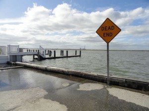
Even on Monday, the bay approaches the top of the bulkhead at 11th Street in Ocean City during high tide. But while the flood waters stretched beyond West Avenue over the weekend, 11th Street was dry on Monday.
High tide passed on Monday afternoon without any significant street flooding, and it appears that Ocean City has finally weathered four-day northeast gale that eroded beaches and left many roads underwater during the highest tides in two years.
The sun returned, the wind faded and the temperature reached a seasonal 65 degrees on Monday afternoon in Ocean City.
The forecast calls for more sun on Tuesday with a high of 69 degrees and a north wind that will fade to just 5 to 10 mph by the end of the day.
Ocean City was in a weather pattern that generated extremely strong northeast winds for about two weeks, intensifying between Thursday and Sunday.
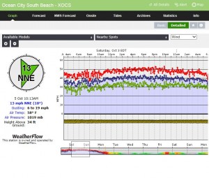
A wind gauge at the top of the beach at 59th Street in Ocean City shows gusts that peaked between noon and midnight Saturday, Oct. 3.
In one stretch from noon to midnight Saturday, the sustained winds never dipped below 40 mph and gusts not below 50 mph at 59th Street in Ocean City. The high tides were exceptional but so were the low tides, with the water never truly draining from the back bays.
On Monday, the bay was still high but not near the levels of the previous four days.
With the wind turning a bit from the northeast to the north, wave heights increased through the morning hours on Monday, likely assisted by swell from distant Hurricane Joaquin, which is spinning toward the middle of the Atlantic Ocean.
The surf should continue to improve with lighter north winds on Tuesday and possible shift to the west on Wednesday.
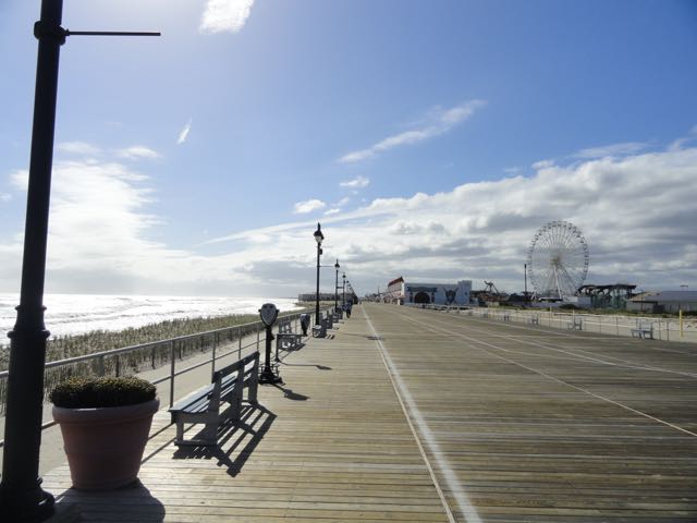
Blue sky returns to Ocean City for the first time in a week.
 Even on Monday, the bay approaches the top of the bulkhead at 11th Street in Ocean City during high tide. But while the flood waters stretched beyond West Avenue over the weekend, 11th Street was dry on Monday.
High tide passed on Monday afternoon without any significant street flooding, and it appears that Ocean City has finally weathered four-day northeast gale that eroded beaches and left many roads underwater during the highest tides in two years.
The sun returned, the wind faded and the temperature reached a seasonal 65 degrees on Monday afternoon in Ocean City.
The forecast calls for more sun on Tuesday with a high of 69 degrees and a north wind that will fade to just 5 to 10 mph by the end of the day.
Ocean City was in a weather pattern that generated extremely strong northeast winds for about two weeks, intensifying between Thursday and Sunday.
 A wind gauge at the top of the beach at 59th Street in Ocean City shows gusts that peaked between noon and midnight Saturday, Oct. 3.
In one stretch from noon to midnight Saturday, the sustained winds never dipped below 40 mph and gusts not below 50 mph at 59th Street in Ocean City. The high tides were exceptional but so were the low tides, with the water never truly draining from the back bays.
On Monday, the bay was still high but not near the levels of the previous four days.
With the wind turning a bit from the northeast to the north, wave heights increased through the morning hours on Monday, likely assisted by swell from distant Hurricane Joaquin, which is spinning toward the middle of the Atlantic Ocean.
The surf should continue to improve with lighter north winds on Tuesday and possible shift to the west on Wednesday.
 Blue sky returns to Ocean City for the first time in a week.