
A rollercoaster ride of temperatures as we head into the weekend. After a mild surge the last couple of days pushing temperatures into the 50s with gusty southwesterly winds, a stronger push of cold air will return for the weekend. In addition, we are also watching an area of low pressure which will slide to our south bringing the threat of some wintry weather for Saturday. Unlike last week, this system is weak and there is less cold air in place. Surface temperatures will be climbing above freezing during the day so any precipitation that falls could have a hard time sticking. As warmer air moves in aloft, a period of snow could change to sleet and then rain later in the day on Saturday.
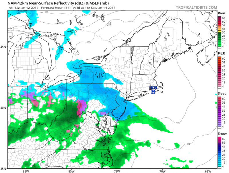 Computer models shows it will be cold enough for snow to start on Saturday (Courtesy: tropicaltidbits.com)
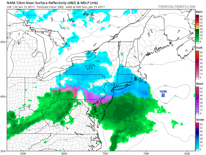 Computer models show precipitation should mix with sleet and eventually change to rain before ending. (Courtesy: tropicaltidbits.com)
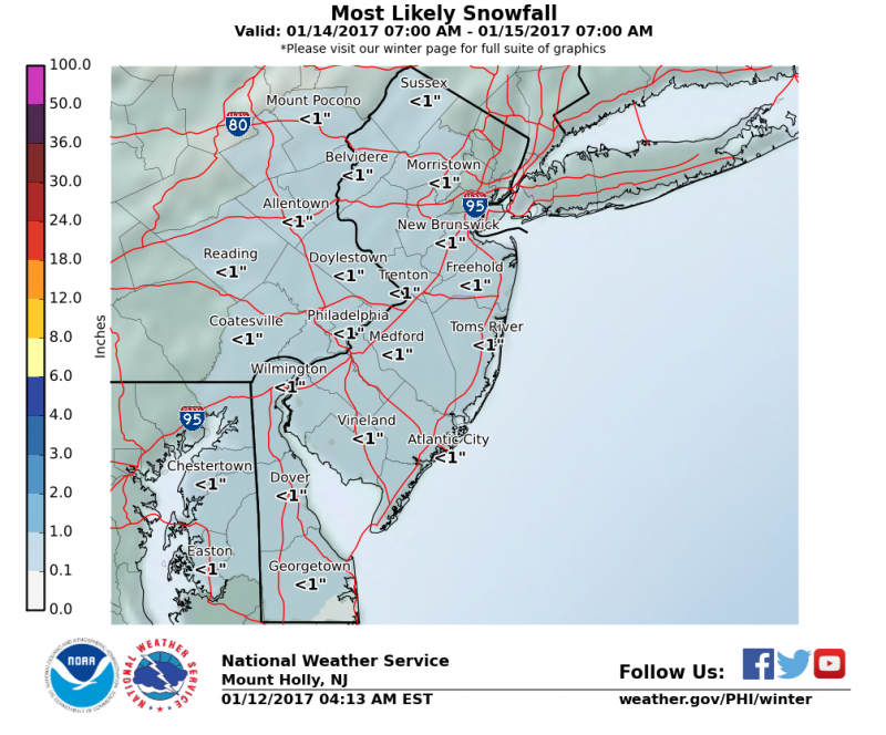
With temperatures climbing to above freezing during the event, only a light accumulation of snow is possible.
Depending on surface temperatures at the time any snow changes to sleet or rain. Only a light glaze of ice is possible.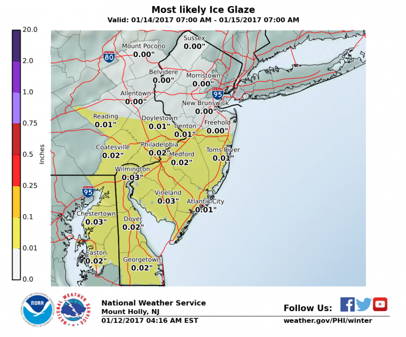
We will continue to watch this minor event for Saturday.
Looking Ahead…
Fortunately, this brief shot of cold air will not last. Sunday & Monday will be dry with temperatures in the low 40s but then the mild pattern returns. Temperatures will climb back into the 50s by mid-week and will continue through the following weekend. If you are snow lovers, this is not the weather pattern for you.
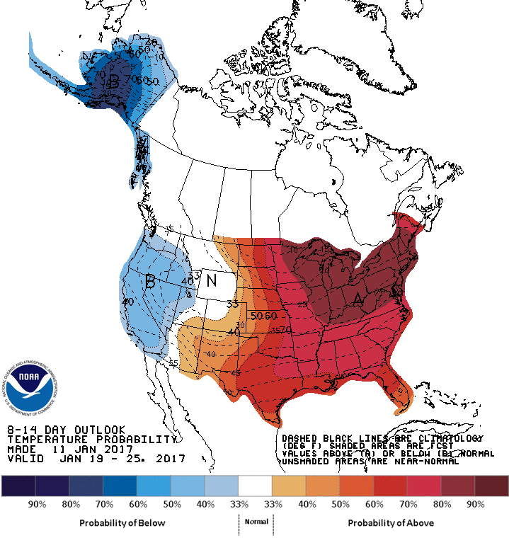 NOAA: 8-14 day temperature outlook shows well above normal temperatures through January 25th.


