
A Winter Weather Advisory is in effect tonight for the possibility of a brief mix of snow & ice. A storm system that will affect us this weekend bring mainly rain for parts of Saturday and Sunday. Luckily, we will be climbing out of our deep freeze before the brunt of the precipitation arrives.
After a starting Friday morning with temperatures in the teens, an approaching storm would usually mean trouble. Fortunately, this storm will track to our west and with a surge of milder air ahead of the system, any frozen precipitation will be short lived. The leading edge of snow/mix will move into our area late Friday night. With temperatures below freezing over the last couple of days, any snow or mix that falls will stick. So roadways could get slick for late tonight into the overnight hours if the precipitation arrives in time.
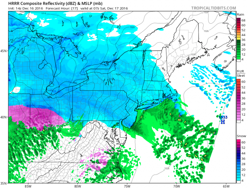
Computers models show a brief shot of snow possible before changeover to rain (Courtesy: tropicaltidbits.com)
However, temperatures will slowly climb and will be above freezing before sunrise on Saturday morning. So the longer it takes to arrive, the less snow/mix we would see. Little or no accumulation is expected before any changeover to rain overnight.
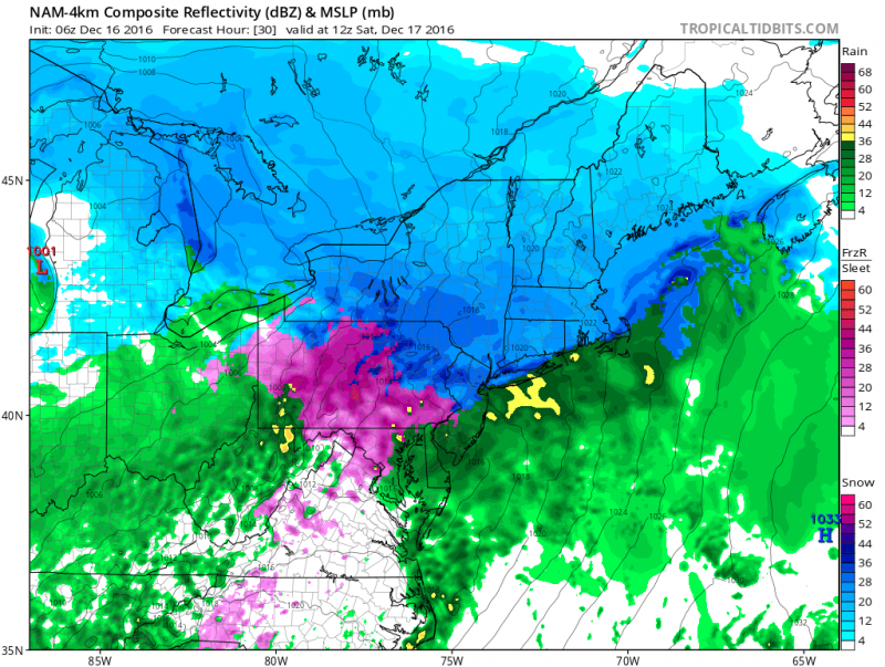 Computer models shows rain across Central and South Jersey and freezing rain across Philadelphia and points north & west. (Courtesy: tropicaltidbits.com)
Rain will continue through Saturday morning and will taper off during the afternoon as the warm front lifts through. It will be breezy and milder during the day as temperatures climb through the 40s and could reach 50 by Saturday evening.
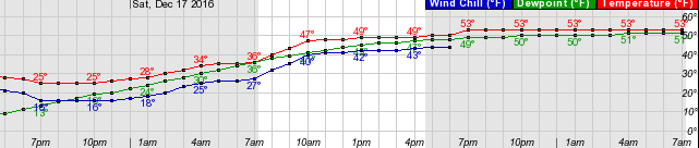 Temperatures climb from the 20s Friday into the 40s Saturday to near 60 by Sunday!
If you are traveling towards Philadelphia and points north & west, a longer period of snow and ice is expected early Saturday morning. Only a couple of inches of snow and ice is expected before a changeover to rain occurs there as well.
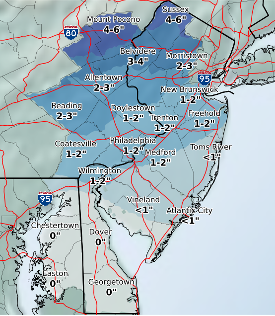 National Weather Service: Forecast Snow Total Through Saturday morning
The next round of rain will arrive Sunday ahead of a cold front. Temperatures will get close to 60 degrees before the front moves through later in the day on Sunday.
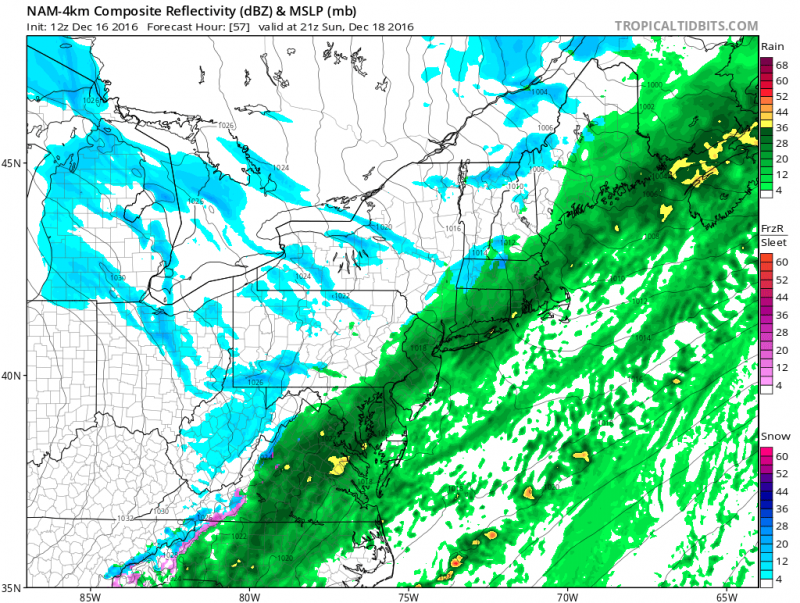 2nd round of rain arrives Sunday afternoon. (Courtesy: tropicaltibits.com)
Cold air returns Monday but not frigid as highs return to the upper 30s to lower 40s early next week.


