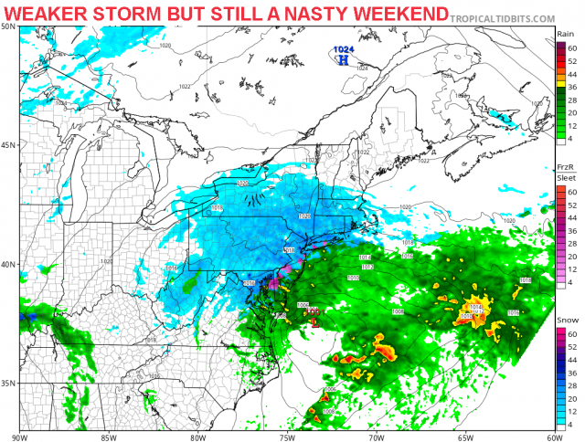
There has been a lot of computer model disagreement this week regarding this upcoming storm. Now models are starting to get in line and here’s the latest. The latest computer models are indicating that the storm will be weaker as it moves off the North Carolina on Saturday and may not intensify until moves off the New England coast. This means precipitation will start a little earlier. Rain will move into Ocean City as early as late Saturday afternoon. As I mentioned the other day, to get snow it will depend on the intensity of the precipitation. As the precipitation comes down heavier, it brings the cold air down as well which can mix or change rain to snow. As the storm pulls away on Sunday, expect a change to snow before ending. Accumulations will be minor. Surface temperatures will be above freezing for most of the event, so if any snow that falls, it will not accumulate on roadways, only cars and grassy surfaces. Some coastal flooding is still possible but is becoming less of a threat as long as this storm does not intensify. However, water levels Sunday morning are still running high due to the approaching full moon next week, so we will continue to keep an eye on it. There is one more computer model coming out this afternoon, so we will see if the weaker trend continues. Regardless, it will be a cold and mainly wet weekend.
Weekend Weather Update


