
Jose has been spinning out in the Atlantic for over 10 days caught between systems. As we move into the weekend, the upper air pattern will finally decide Jose’s final path. Computer models have been showing that Jose would be far enough the coast to avoid any significant impacts to our coast. However, latest computer runs have been indicating that Jose could get close enough to get more than just rough surf and rip currents.
The reason for the uncertainty is a large high pressure in the Atlantic could force Jose further west (closer to the coast) ahead of a trough moving east across the Eastern U.S. The strength of the high pressure and the trough along the East Coast will determine where Jose is funneled north. Dangerous surf (6-10 feet, possibly higher) and strong rip currents are expected through early next week but the threat of some rain and tropical storm force wind gusts are possible Monday night into Tuesday.
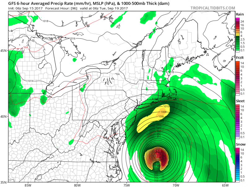 Just one of the many computer models solutions. This one shows rain reaching the coast as Jose stays offshore. (Courtesy:tropicaltidbits.com)
Another threat increasing is coastal flooding. With the new moon next Wednesday, astronomical high tides are already expected. If Jose track closer to coast minor to moderate flooding could occur especially Monday night and Tuesday high tides.
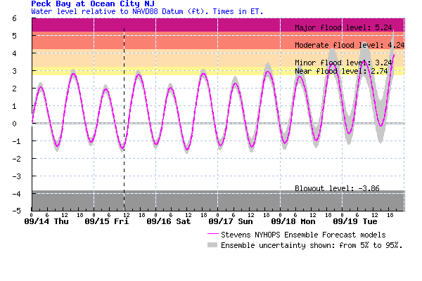
Tide forecast shows tides exceeding flood stage early next week.
While the threat of Tropical Storm conditions are still low along the NJ coast, a bigger threat exists out towards coastal New England. Jose is forecast to be a minimal hurricane when it passes potentially 150-250 miles off the coast by the NJ coast early next week.
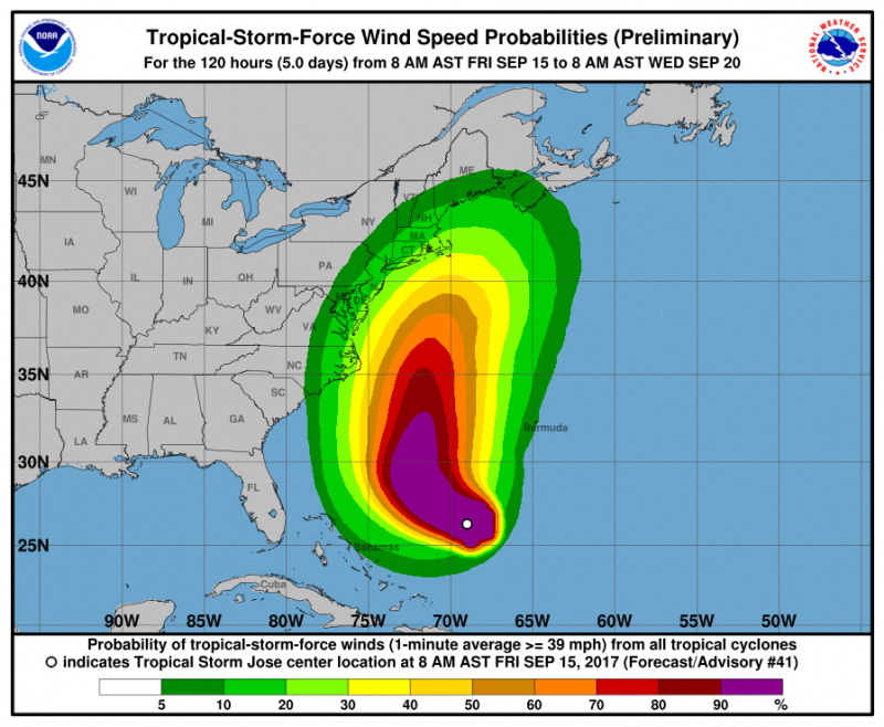
NHC probabilities show a 20% chance of tropical storm conditions from Jose along the NJ Coast.
Keep in mind, we are still too far away to determine the exact track of Jose. Things will become more in focus as we move into the weekend. Stay Tuned.


