The National Weather Service hazardous weather outlook released on Sunday evening suggests that long-period swells from Tropical Storm Bertha could reach the New Jersey coastline from late Monday through Wednesday.
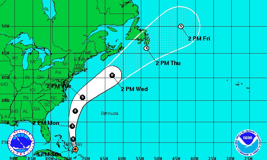
Forecasters predict a track that will take Bertha over the open water of the Atlantic Ocean hundreds of miles from Ocean City. With the possible exception of big surf, the storm is not expected to affect Ocean City.
With sustained winds of 45 mph, Bertha was expected to pass the Bahamas on Sunday night. Forecasters do not anticipate significant strengthening in the next 24 hours. There’s some possibility the storm could gather strength and become a hurricane (winds of at least 74 mph) as it moves up the Atlantic at mid-week.
The storm would pass Ocean City late Tuesday into Wednesday, according to the latest track forecast.
If Bertha is strong enough and passes close enough to generate surf, conditions look good for local surfers. Local winds will be light northeast on Tuesday and offshore (out of the west) on Wednesday. High tide will be late afternoon on the ocean beaches.
The increased surf would increase the risk of undertows and rip currents for swimmers, who are always asked to swim only at beaches protected by the Ocean City Beach Patrol and never after the OCBP goes off duty.
__________
Sign up for OCNJ Daily’s free newsletter and breaking news alerts
“Like” us on Facebook


