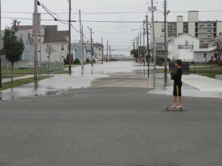
Streets flooded and waves crashed into dunes again on Sunday afternoon, but the intensity of a northeast gale that has battered Ocean City for four days appears to be diminishing.
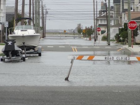
Some intersections that were underwater on Saturday afternoon were dry on Sunday. The wind is not quite as strong, and the tide levels not as high.
A gale warning remained in effect through 10 a.m. Monday morning with northeast winds expected to gust beyond 45 mph on the ocean, according to the marine forecast. But by Monday afternoon, the sun is expected to return and the winds are expected to fade to 20 to 25 mph, before decreasing even more for Tuesday.
The end is in sight for a more than two-week stretch of northeast winds caused by two competing weather systems that remained stationary on either side of Ocean City. The weather has flooded streets (see “Northeast Gale Continues to Flood Ocean City“) and eroded beaches (see “Gale Leaves Major Erosion of Ocean City Beaches“) in Ocean City.
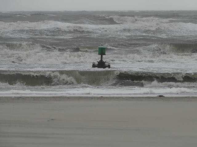
Unrelated to the northeast gale, Hurricane Joaquin is expected to pass by Ocean City far out to sea. But the powerful storm had 100 mph sustained winds on Sunday evening and is expected to send waves toward Ocean City starting on Monday. The local northeast winds already have churned up a swirl of big and powerful surf.
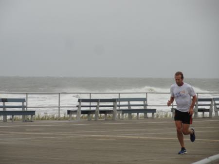
By Tuesday afternoon, local winds could shift and provide the favorable conditions local surfers have been craving.
Peak tide level: (See tide level in real time at the Bayside Center on the 500 block of Bay Avenue in Ocean City. Add 2.77 to convert NAVD88 readings to MLW.)
- 11:48 a.m. Thursday: 6.64 feet
- 12:12 a.m. Friday: 6.45 feet
- 12:35 p.m. Friday: 7.35 feet
- 12:54 a.m. Saturday: 7.09 feet
- 1:18 p.m. Saturday: 7.21 feet
- 1:48 a.m. Sunday: 6.53 feet
- 2 p.m. Sunday: 6.80 feet
How high is that tide? The 7.35 feet is the highest tide of the calendar years 2014 and 2015. The weekend’s tides fall in what forecasters call “moderate tidal flooding” range of 6.5 feet to 7.5 feet. Superstorm Sandy, by comparison, was a record 10.02 feet on the MLW scale, and the memorable November 2009 nor’easter was 8.02 feet. (See OCNJ Daily’s chart of historic and recent record flood levels.)
National Weather Service Briefing: Read the most current briefing from the NWS.
High Tides: Residents and visitors should be aware of the following high tides (on Ocean City’s bay side at the Ninth Street Bridge) and be prepared to move vehicles from flood-prone streets:
- Monday: 2:41 a.m. and 3:04 p.m.
Follow OCNJ Daily
Sign up for our free news updates from Ocean City. Check back with OCNJ Daily for photographs and reports on real-time conditions in Ocean City.


